Redhot Mapping
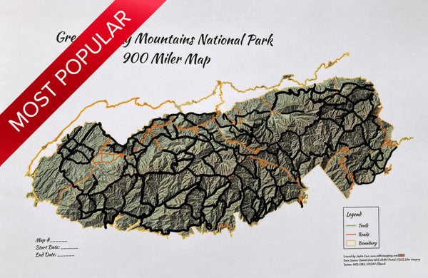
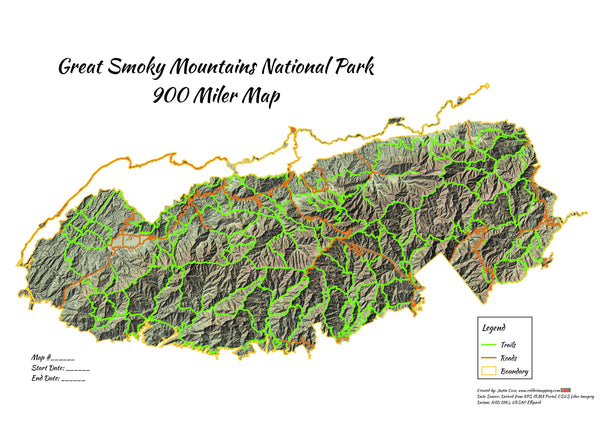
Smokies 900 Miler Lidar 12"x18",18"x24"
Details
- Each trail is beautifully hand painted
- Back of map includes an embedded 900 Miler spreadsheet as found here with date and notes column empty for you to fill out. Note: Trail mileages do not include access, nature, quiet walkway, horse trails, and cemetery access type trails that are not included in 900 Miler list.
- Write in map number, start date, and end date located on on front, bottom left for the first timer or returning veteran
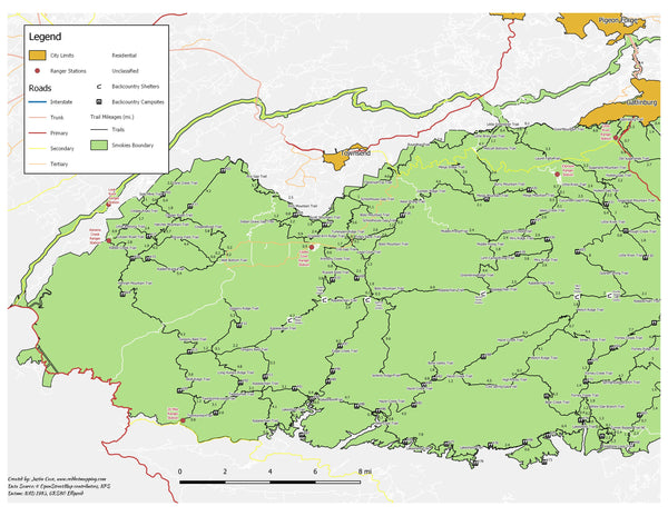
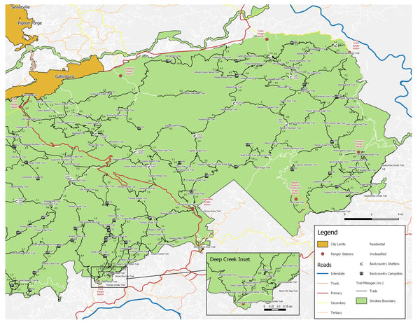
- 1 Smokies Inset Map included per map to reference trails, roads, ranger stations, campsites on one page
- Two styles: Scratch Off and Not Scratch
Tech Specs
-
Size: 12" x 18"
-
Laminated flush trim
- 1 ultra fine permanent marker per map
- **Coin for scratching and extra acrylic paint NOT included**
Data Sources
-
Ancillary datasets (trails, roads, boundary) were sourced at NPS Irma Portal for Smokies NP
-
Most up to date topographic hillshade relief using state of the art lidar technology from USGS (Projects were flown by various agencies in 2015,2016, and 2017). 12/24/2019 NPS Published Date. Other ancillary datasets (trails, roads, boundary) were found at NPS Irma Portal.\
Liz Etnier Guide Book for 900 Miler
- Please visit http://www.smokymountainshiking.com/ for a comprehensive guide book on hiking all the trails in the Smokies the most efficient way, created by Knoxville local Liz Etnier. Liz Etnier provides you with an approach to hiking all of these trails that minimizes duplication of miles hiked while ensuring that no trail segments, or spurs, are left behind. If you follow her approach, you can hike all the maintained trails in the Smokies in a total of only 1090 miles!


Regular price
$34.99
Taxes and shipping calculated at checkout
- choosing a selection results in a full page refresh
- Opens in a new window.
- Opens external website in a new window.


